![]()
LATEST STORIES:
![]()
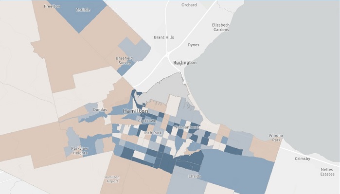
The City of Hamilton released an interactive online map showing the location of confirmed and presumptive cases of COVID-19.
The map only gives general locations based on census tracts in the city, not specific addresses of people who tested positive.
The map shows that rates seem to fluctuate throughout the city.
The dark blue areas represent those with the most cases, while the lighter beige areas show those with the least.
Important to keep in mind is that the map shows where the cases live, not where they acquired the virus.
To view the full interactive map, visit https://www.hamilton.ca/coronavirus/status-cases-in-hamilton and scroll to the bottom of the page.