![]()
LATEST STORIES:
![]()
On the hundredth anniversary of “The Great War”, map specialists at McMaster University in Hamilton are using new technology to preserve some very old artifacts. They’re working on the world’s largest digital collection of World War I maps, to make them accessible to everyone.
In an age of rationing, when all resources were directed at war, film footage was rare. But maps were plentiful. Carefully guiding soldiers through intricate battle manoeuvres.
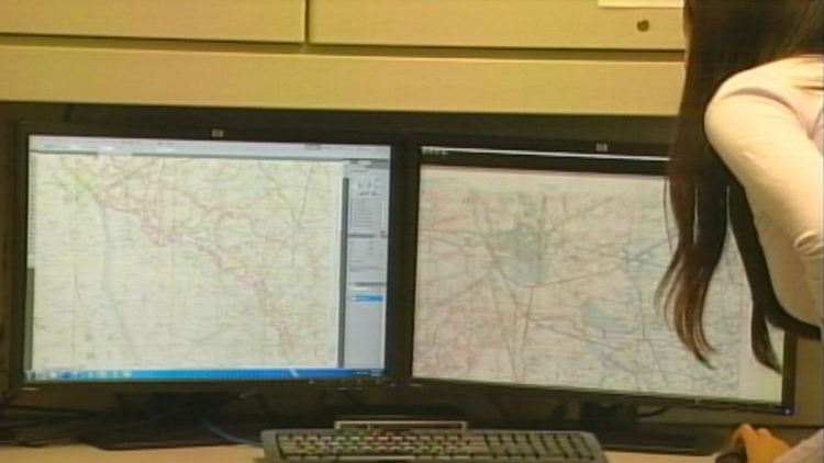
This map for the 1918 Battle of Cambrai plans the calculated advancement of troops across “no man’s land.”
Gord Beck is a map specialist at McMaster: “Seeing it all drawn out in such huge detail is unbelievable that they could actually coordinate something like that and for the men to trust that those artillery barrages would keep moving in front of them.”
Soon, people around the world will be able to re-imagine this and other World War One battles through a collection of 1,500 maps on McMaster’s library database.
The hundred-year old maps are being scanned and individually edited to offer a magnified look at history.
On the original map, the symbol for a machine gun is about the size of a pin head. But when you digitize it, you can zoom in, making it even bigger than my thumb.
It’s not just the detail of the maps that makes digitizing worthwhile. Online, their unique attributes are accessible to thousands.
Gord Beck: “Even if someone has the same map, a lot of our maps contain hand written details by individuals soldiers, indicating plans for upcoming battles, that sort of thing.”
In one pencilled note, a soldier tells of pocketing a pair of opera glasses after overtaking a German trench. And for a map expert like Gord Beck, touches like that make history worth sharing.