![]()
LATEST STORIES:
![]()
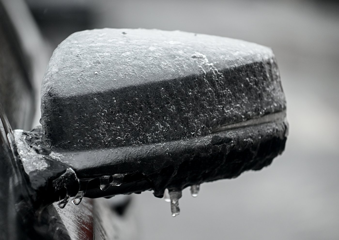
A massive spring storm has descended on Ontario with damaging conditions in store for parts of the province still without power from the last bout of freezing rain.
Weather warnings issued by Environment Canada cover most of Ontario, ranging from snowfall in the north to rainfall and freezing rain across the south and east. Freezing rain warnings were also in place for large parts of Quebec, where the storm was expected to advance by Wednesday night.
“We’re looking at pretty much every type of severe weather you can think of being associated with this one system,” said Geoff Coulson, a warning preparedness meteorologist with Environment Canada.
Flood warnings are in effect in several areas in anticipation of Wednesday’s storm, with heavy rainfall set to hit already saturated ground.
Power outages are also possible as weakened power lines and trees are hit by another round of high winds and freezing rain.
Hydro One says crews have been working around the clock since the last storm blew through to restore power to hundreds of thousands of homes. As of Wednesday morning, more than 200,000 customers were still without power.
“This is the worst storm we’ve experienced since the ice storm in 1998 and the damage is severe and widespread,” spokesperson Tiziana Baccega Rosa said in a statement.
She said Wednesday’s storm could slow restoration efforts and cause additional outages.
Freezing rain was expected to be felt hardest in some of the communities still reeling from the weekend.
Environment Canada said Wednesday’s storm would not be “nearly as significant” as the recent ice storm but warned areas around Georgian Bay to Peterborough could see between four and eight millimetres of ice buildup, combined with gusting winds.
Mayor Don McIsaac of Orillia, which remained under a local state of emergency, said he was relieved the worst of the ice storm was behind them but told residents to stay alert.
“The city is actively preparing for this and will continue to adapt as the situation evolves,” he said in a statement.
Areas from Windsor to Toronto could see between 30 to 50 millimetres of rain. Those totals could be higher in some areas due to the risk of damaging thunderstorms, with possible wind gusts up to 90 km/h.
Snow and ice pellets were expected to advance Wednesday afternoon on eastern and northern Ontario, including Ottawa and areas from Sudbury north to Wawa, before flipping to freezing rain later in the day, Environment Canada said.
Thunder Bay could see up to 30 centimetres of snow, heavy at times, with between 15 and 20 centimetres in the forecast for areas toward the Manitoba border.
This report by The Canadian Press was first published April 2, 2025.
Jordan Omstead, The Canadian Press