![]()
LATEST STORIES:
![]()
Residents of Southern Ontario woke up Monday to a scene from a Christmas card. The snow fell through the morning, forcing drivers to find their brushes to wipe off their cars and homeowners were shoveling their sidewalks.
The November day looked more like a January day. And the winter wonderland is not over yet. Forecasters say the south end of Niagara will be in the bull’s-eye of a lake effect blast.
The winds began to pick up before the dinner hour. It began snowing more heavily. Forecasters are telling people here to brace themselves for blizzard-like conditions.
This is what’s heading our way — bone chilling temperatures, gusty winds, and enough lake effect snow to make travelling treacherous.
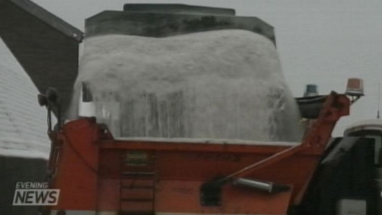
Niagara region has brined 1,700 kilometres of roadways.
Now comes the salt.
Dave MacLeod, Niagara region: “We’re looking at continually going for the next two and a half days, in advance of the storm, right around the clock? You bet ya!”
By the time it’s over they’ll have put down about four-thousand tons of salt.
It was slippery this morning. A man was rushed to hospital with a broken leg and lacerations to his face when his car plowed into a city transit bus on the Glenridge Hill near Brock University. By noon, Niagara police had already dealt with about 20 collisions.
It rained in Fort Erie in the afternoon, but the forecasters are predicting that by Tuesday night, the shoreline of Lake Erie will see more than 30 centimetres of snow.
“Snowblower’s ready. Shovels are ready.”
Some people are refusing to believe it.
“Can’t you tell?. I’m still in my summer shoes.”
Forecasters are saying that the morning commute will be dicey on Tuesday morning.